 =0=
=0=
 =0=
=0=
 =0=
=0=
 =0=
=0=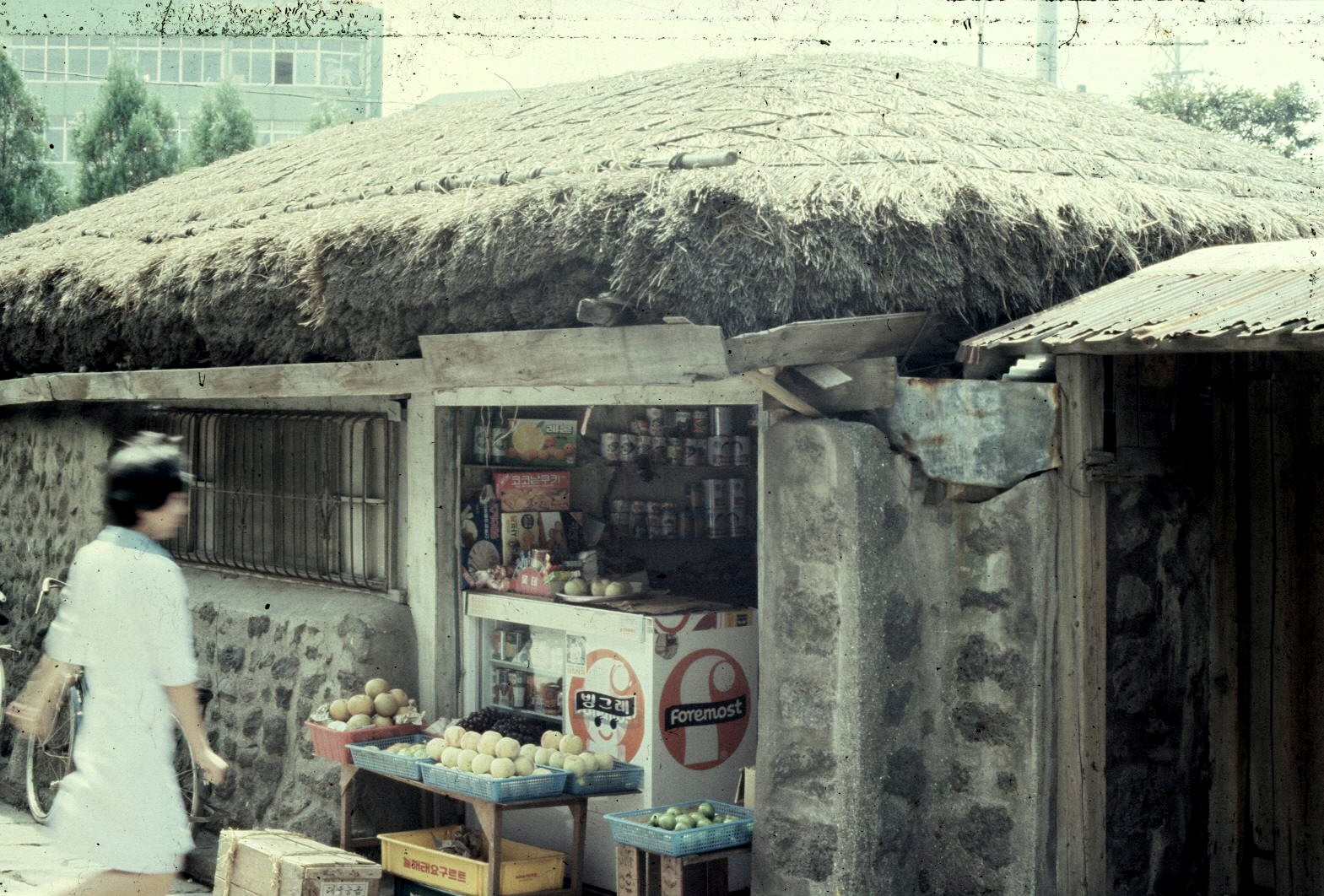
 =0=
=0=
 =0=
=0=
 =0=
=0=
 =0=
=0=
 =0=
=0=
 =0=
=0=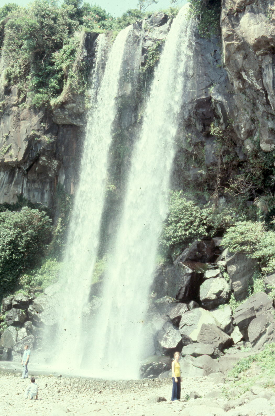
 =0=
=0=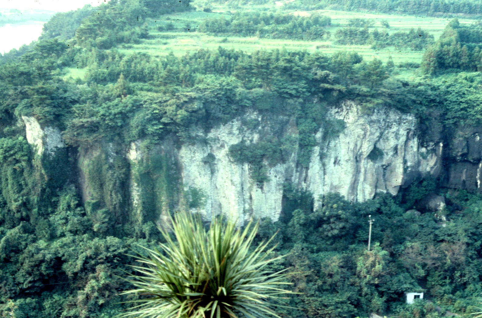
 =0=
=0=
 =0=
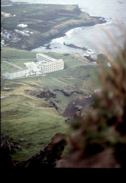
=0=| This is the hotel we stayed at. The trail up to the top covered a pretty fair distance. |
=0= |
| This is the trail we took on the way up (and on the way down). As you can see, it is pretty steep as you approach the top. |
=0= |
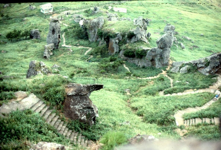
| On the way down we were able to see more and take more pictures. This is a monument. Also, to the left there is Korean writing on the rock. We don't know what it meant, but as Korean uses a phonetic alphabet (the components of the writing tell you how to pronounce the work), it is pronouced, Tong Wah Soo. I like to imagine that says Tong loves Soo.... In the distance behind the monument is a cliff that is famous as people see human profiles in its various shapes. |
=0= |
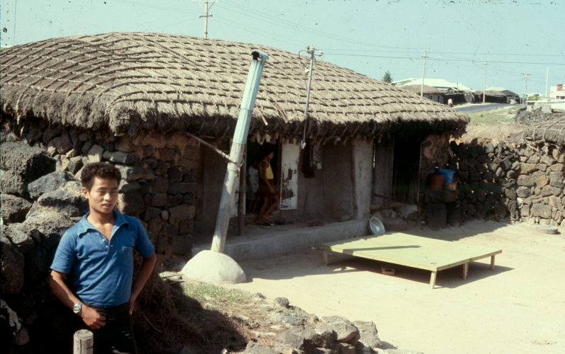
| Then we went to the capital (or more precisely, district center) of Cheju Doh, which was quite a burgeoning metropolis. This is their equivalent of a 7-11. It seems to be an extension of someone's home, which was common (many tiny shops were like that) and a traditional home at that. The roof is thatch tied down with ropes and the walls are volcanic rock with mortar inbetween. This seems to be a nurse dashing in from the modern building just across the way. Perhaps to pick up a 'Chu Chu Bah' or frozen koolaid stick like we later gave to our own kids, though I don't remember them from my childhood. |
=0= |
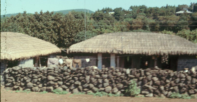
| We visited the coutryside as well which was quite beautiful. We saw several traditional farmhouses which were somewhat low on the ground and with lots of ropes to hold down the thatch roof. It seems that hurricanes which make it up to Korea hit Cheju Doh pretty hard but then veer off to the side and don't really hit much of the rest of Korea. |
=0= |
| This is another farmhouse. The tour guide had suggested that I take pictures of a particular house, but I preferred this one because it had a more typical look, sort of rough and lived in look. Also, in light of the hurricanes perhaps the low walls are just good sense as the high walls you see in the Korean mainland could be pretty hazardous in high winds. |
=0= |
| This is the farmhouse that the tour guide recommended we take pictures of. Of particular interest is the stove pipe. This house would have On Dal heating which is where the yun tun (or coal bricks) are put into a hole on the far side of the house and the exhaust goes through the floor (exhaust pipes imbedded in the cement) and then comes out via the stove pipe. This is quite efficient (and warm floors are very nice), but pretty hazardous as leaks in the exhaust pipes often lead to the occupants of the house dying of asphyxiation or carbon monoxide poisoning. As a result, in better off houses (like the ones we stayed in) there is a regular heat exchanger (like a heater in the States, but burning yun tun) which produces hot water which is pumped through the floors of the house. Much safer and you still get warm floors. The platform in front of the house is also interesting because in warmer weather the family would often eat, sleep, and generally just live on a platform like that. Presumably in the heat of the day the inside of the house would be nicer, but in the evenings and night (while the thick walls are still retaining the heat of the day), outside on the platform would be most comfortable. |
=0= |
| The tour took us around the country side of Cheju Doh and we saw many fields with sort of scraggly bushes which were sesame seed plants. This field has been harvested in the the bushes have been cut down and the stalks tied in bundles to dry. Once the stalks are dry, a sheet of canvas is laid out (as you can see here) and stalks are beaten on the canvas until the seeds are loose. The seeds can be sold directly or crushed to make sesame seed oil which is a common ingredient in oriental cooking. Most of Korean sesame seed oil comes from Cheju Doh. |
=0= |
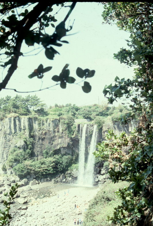
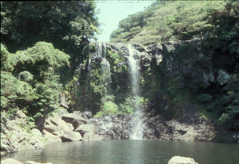
| Most of Korea does not have very much interesting geography. There tends to be flat land which is densely farmed with very flat rice fields (so that they can be flooded) and mountains which are smaller pine trees. However, in Cheju Doh you get more contrast with foothills and such in between the fields and mountain. This is a picture of a waterfall along the coast. |
=0= |
| This is a closer view of the waterfall so that you can get some idea of the size. That is Barbara standing close to the base of the waterfall. |
=0= |
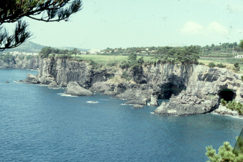
| This (and the pictures below) is the view from the hotel where we stayed the second night. You can see some limestone cliffs above the sea as well as a beautiful bay. There was also a stream that led to a waterfall which fed into the sea. A very beautful location. |
=0= |
|
=0= |
=0= |
This page was last updated on September 5, 2005.