 =0=
=0=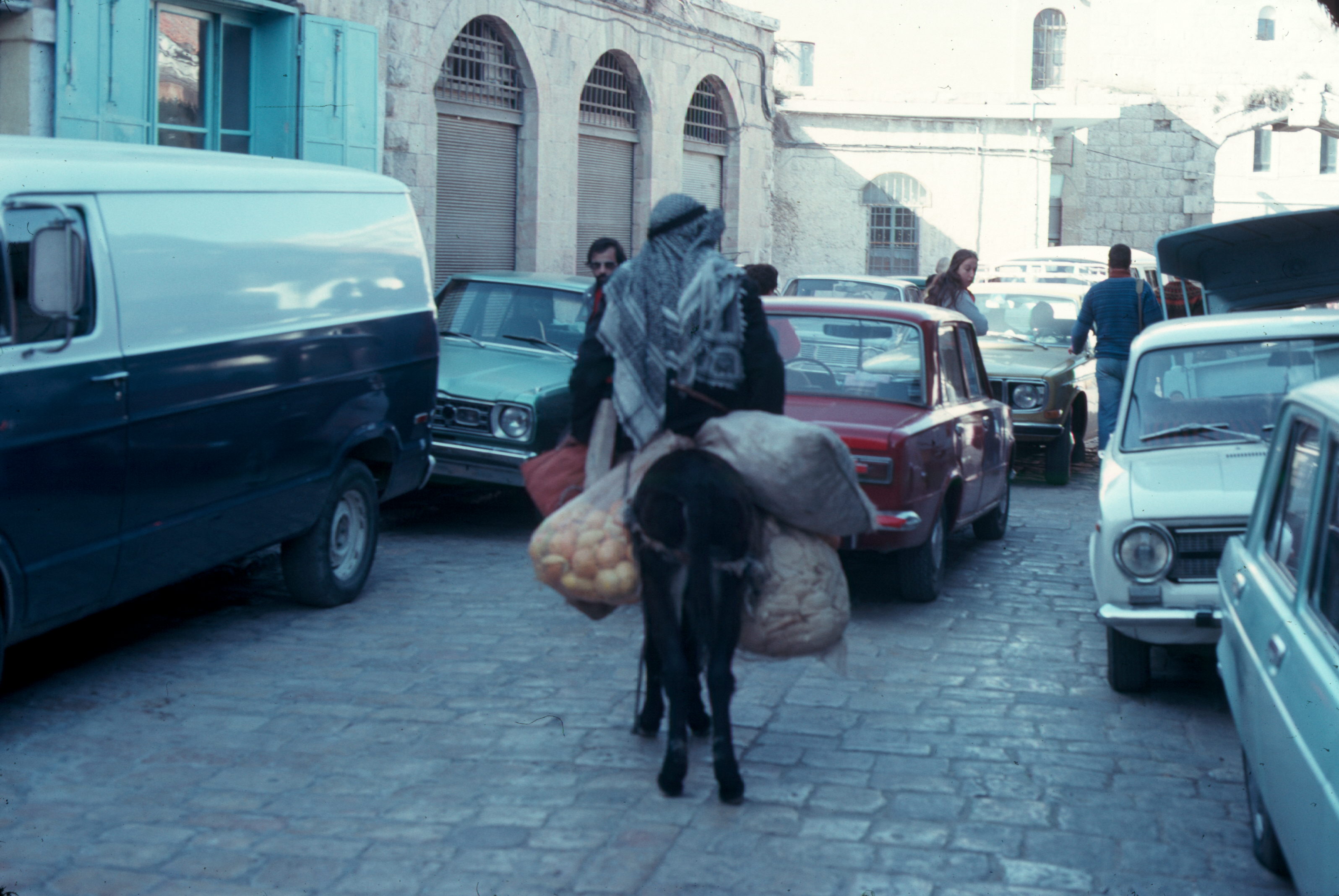
 =0=
=0=
 =0=
=0=
 =0=
=0=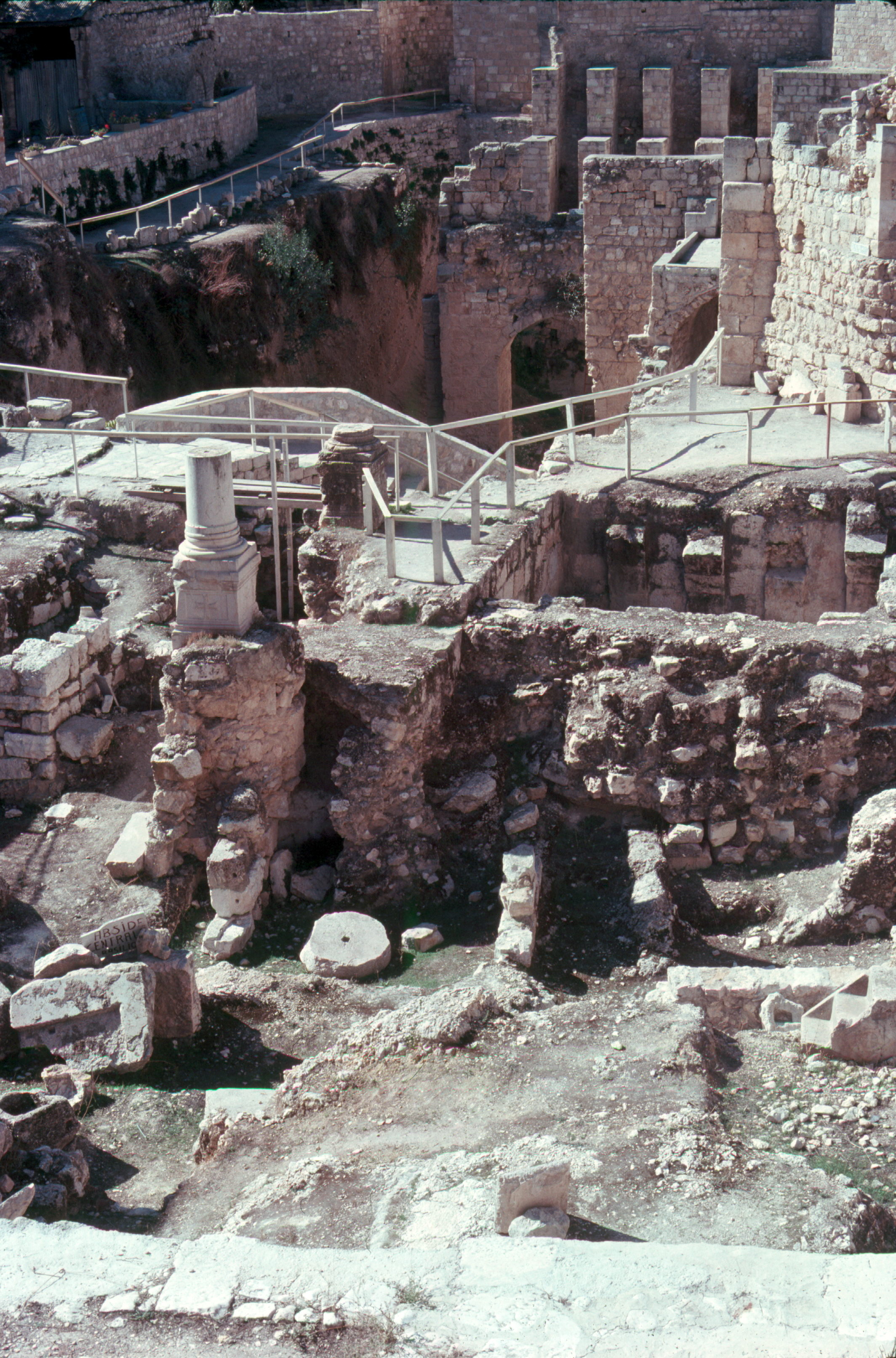
 =0=
=0=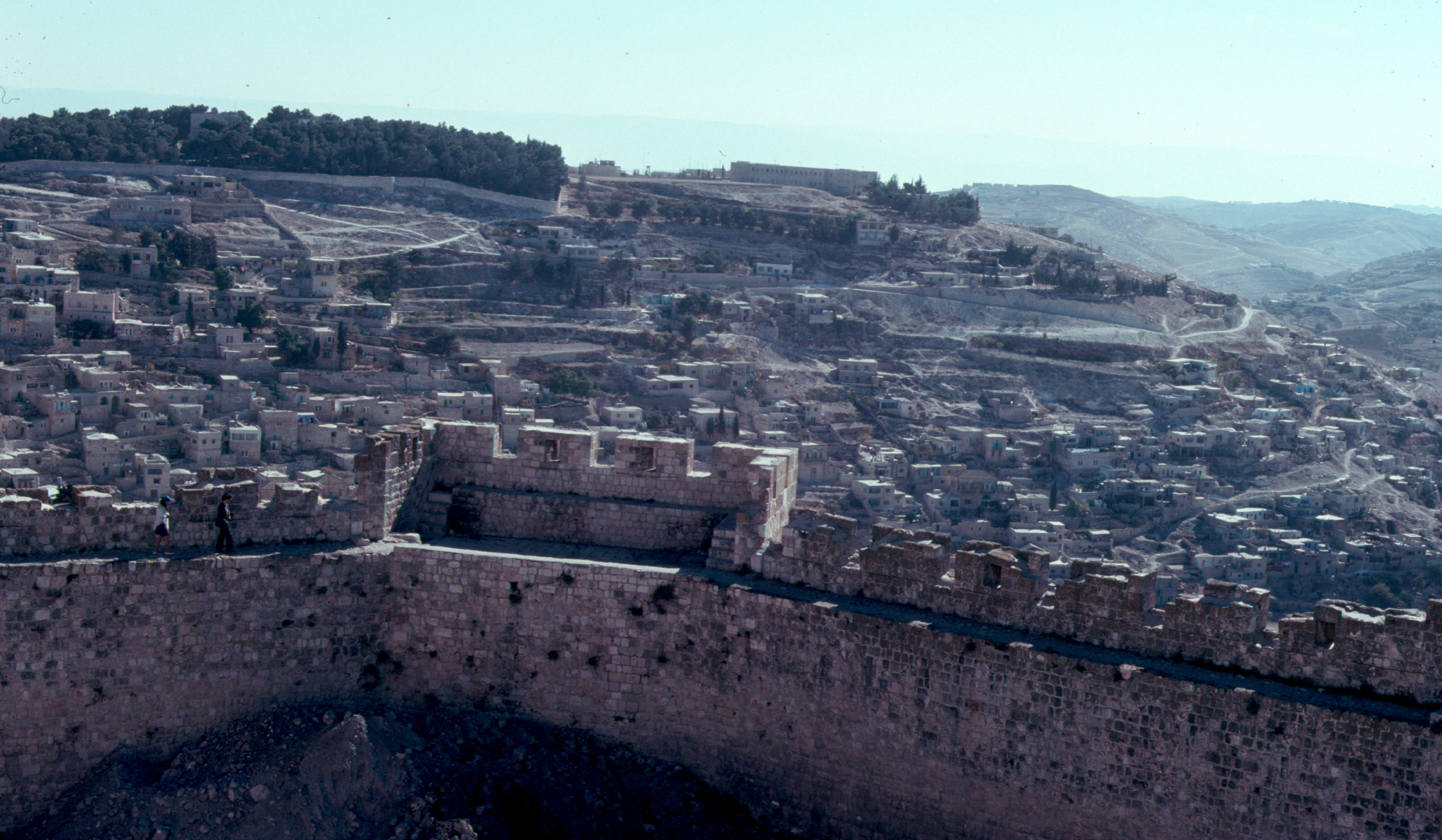
 =0=
=0=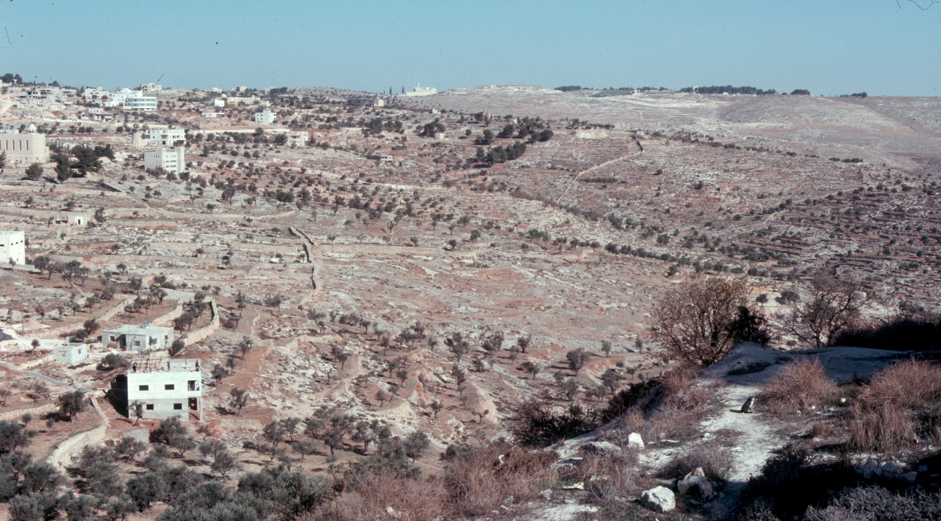
 =0=
=0=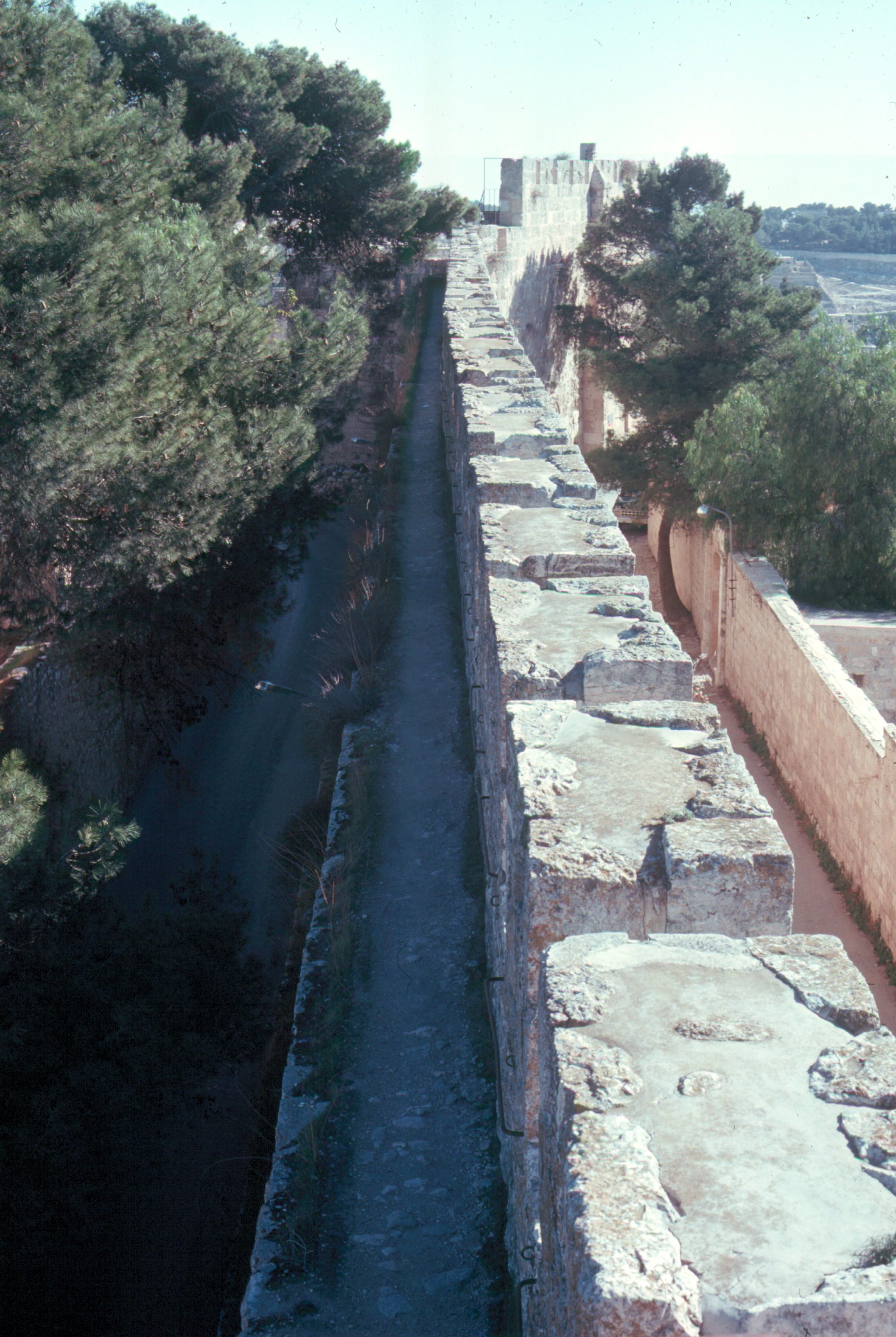
 =0=
=0=
 =0=
=0=
 =0=
=0=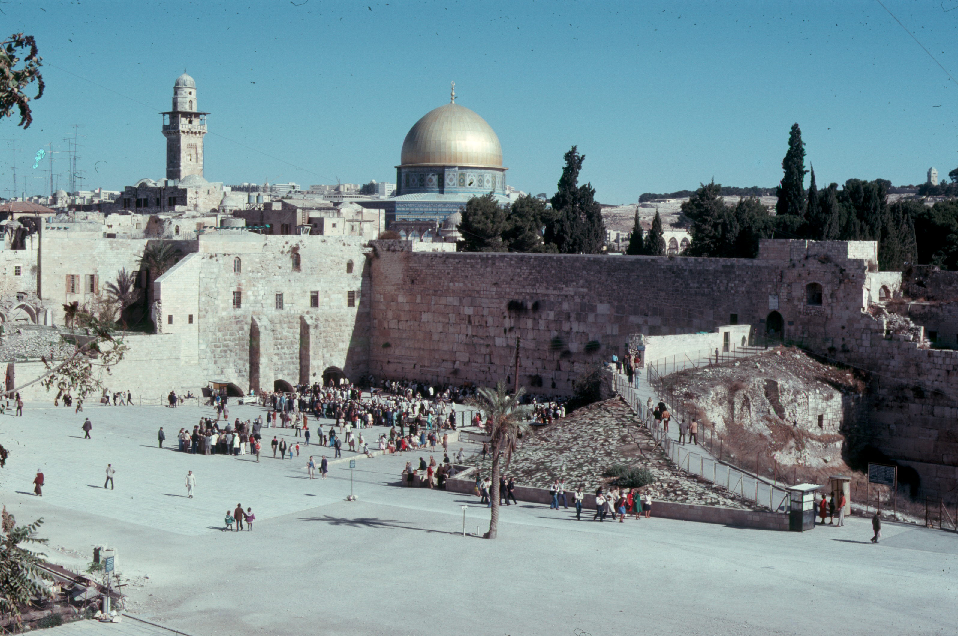
 =0=
=0=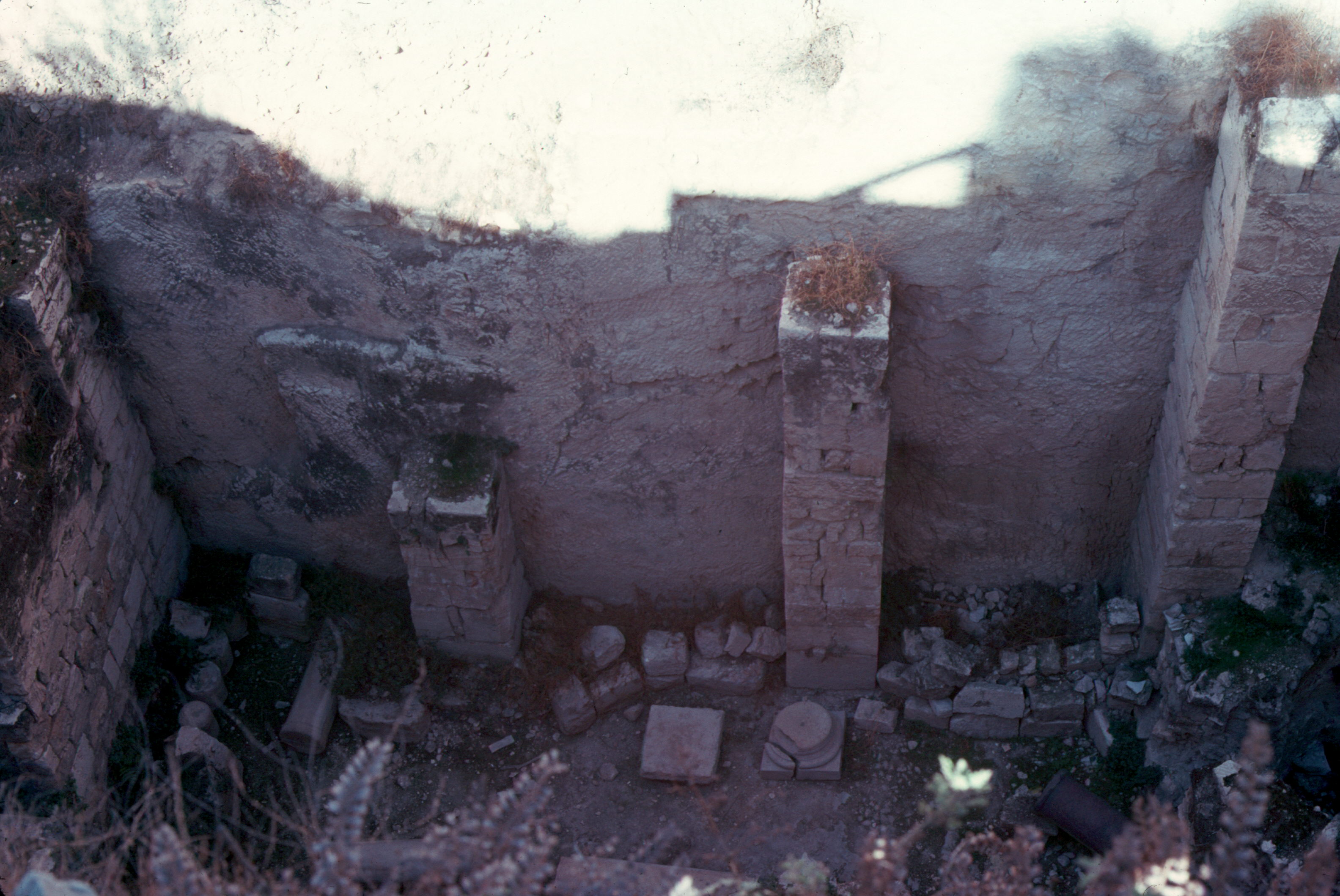
 =0=
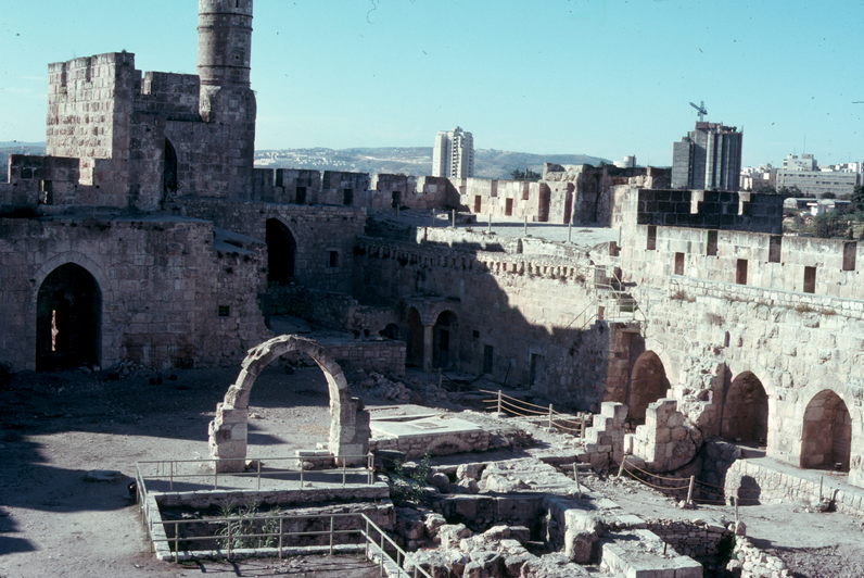
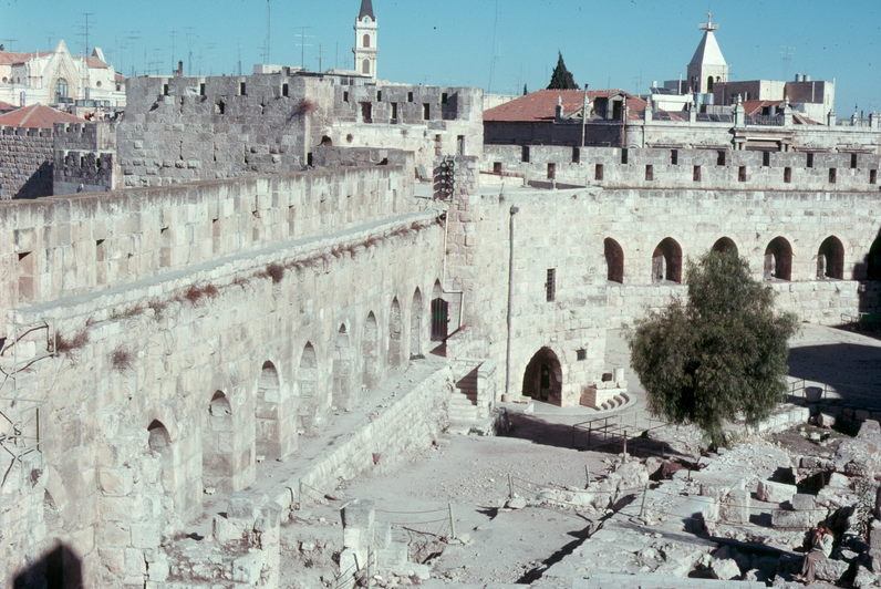
=0=| That gate led into one of the few sections where cars were alloweed, but they only went a couple of blocks so that is was mostly just a place to park cars. This is a picture of an arab taking a load of fruit to the market. He could take his goods most anywhere in the old city while cars and trucks could only go in a short distince. Below is a slide of the Fortress of David. The old city expanded and contracted over the years, but this fortress was always a part of Jerusalem and was where the current soldiers would be garrisoned. On the right below is an over view of a section of the fortress that is being excavated to determine what the fortress would have been like when the Romans had a garrison there (before the modifications made by the Turks and other occupiers of the city. |
=0= |
|
=0= |
=0= |
| This is another view of their archaelogical digs. If you notice they have put in elevated paths so that the tourists can get around and see what they have uncovered. Below on the left is a view from the old city of the city wall as well as new sections of Jerusalem. Next to that is another picture from Jerusalem but in an area that is not yet densely developed. Of course it is quite arid throughout. |
=0= |
|
=0= |
=0= |
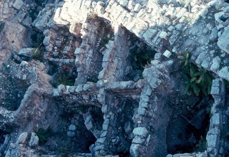
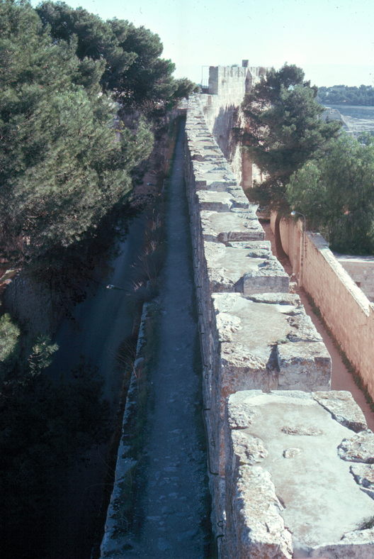
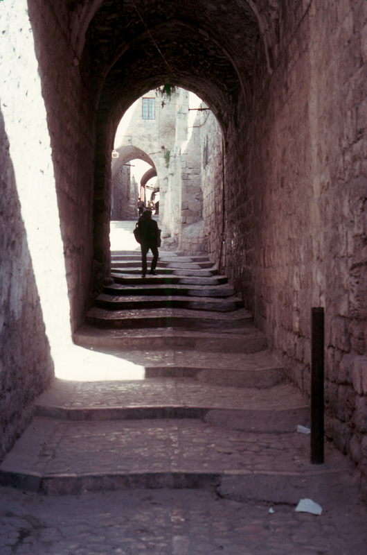
| This is a view from a battlement over a section of wall. The wall would be about 20 feet tall with the very top section about 18 inches wide. Inside (to the left) would be a path which is about three feet lower and also about 18 inches wide. About ten feet down from that would be another path so that at the base the wall would be about four feet wide. I was able to walk along the path while Barbara walked on the road beside the wall (wide enough for cars). The path was a little scary as there was no railing or anything to stop your fall. Below is a picture of one of the paths around the old city. It reminded us a lot of the narrow alleyways in Daegu, but there weren't the regular roads at all. You can also see how on the right they had compromised with modern times and filled in part of the old steps to allow wheeled devices (though certainly not cars). Throughout Jersalem there is a lot of archaelogical digs (on the right below) as well as new construction. However, even with the new construction they still do not put in wider roads in the old city. That piture is from very close to the Wailing Wall. |
=0= |
|
=0= |
=0= |
|
=0= |
=0= |
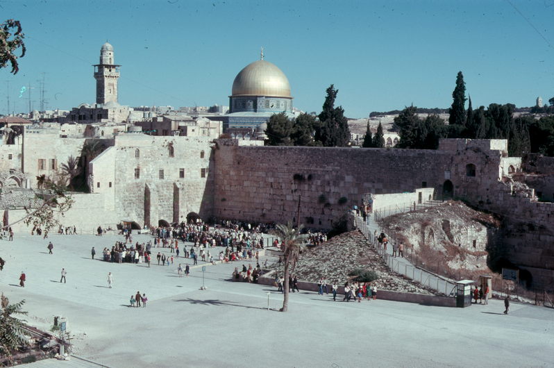
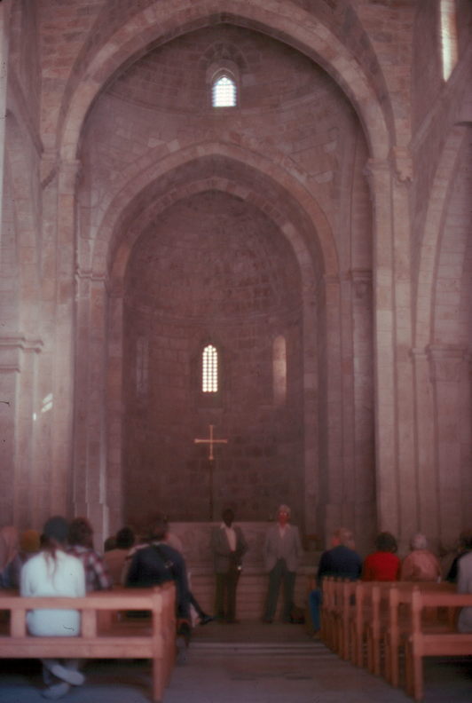
| Above on the left is the Wailing Wall (the wall in shadow). On the day we visited the old city it was the Sabbath and there were signs asking that you not pictures beyond this point. Beyond the Waling Wall you can see the Mosque of Omar which has the golden dome. It is also called the Mosque of the Rock because inside of it there is a massive rock about four yards long and 2.5 yards wide. Chrisian, Jews and Moslems all have spiritual traditions tied to the rock. The mosque was quite impressive with a large open area with supporting pillars and persian rugs, sometimes many layers thick. Mohammed left for heaven the first time from there and it is also supposed to be the cornerstone of the temple and also the stone where Abraham would have sacrifced Isaac. The next slide is of the Pool of Betheta which is where Mary was supposed to have been born. The bath itself is about ten yards below the current city level and you can go down there via ladders but we were impressed that the level of the city had been raised that much of the years by people just knocking down the old and building anew on top of it (which is good for achaelogists, I guess). This picture is of a nearby crusader church which is just built of simple stone without many decorations but which has excellent acoustics. There are a lot of Christians who take tours of Jerusalem and most go by the chruch to sing a hymn. When we were outside it sounded like they had a massive choir, but it was really only about ten people but with really excellent acoustics. |
=0= |
This page was last updated on December 21, 2005.